
Finding Who Lives Along a Placer County Street
A Placer County street directory search should begin with one exact address. The parcel record can identify an owner or mailing destination, but it does not identify every person who occupies the parcel. A deed names parties to a transaction. A permit names participants in a project. A historical directory captures a household at a particular time. Put those roles beside the result instead of merging them into a single label.
The address workflow is deliberate. It works across South Placer subdivisions, foothill roads, and Tahoe communities where postal names and government jurisdiction do not always match. Preserve the city line as written, but let GIS and the parcel record decide where to send a permit or records request.
- Enter the exact street address in the Placer GIS open-data map or the county's GIS gateway.
- Capture the APN, parcel shape, situs, and jurisdiction shown by the map or linked official record.
- Carry the supported 12-digit parcel or assessment identifier into the tax inquiry when the live interface asks for it.
- Use the parcel and owner history to choose names and dates for the Recorder grantor-grantee index.
- Check permits, voter-file rules, or a reverse directory only for the specific question that remains.
Note: Walk a street parcel by parcel, and keep the street's units, corner lots, and separate APNs distinct.
Placer County Address Search to APN
The county property tools do not all accept the same key. GIS is the address-to-parcel bridge. The Assessment Inquiry documented by the county accepts a 12-digit Fee Parcel Number or a 12-digit Assessment Number, along with an aircraft tail number option. It is not safe to promise an address field on that tax screen. Start with the Placer County GIS and Online Maps route, then follow the identifier to the tax account.
Write down the situs address, the owner mailing address, the APN or assessment number, and the legal description in separate columns. Situs means the physical location tied to the tax account. Mailing means where correspondence is sent. The legal description carries subdivision, lot, or metes-and-bounds continuity. A mailing address that matches the situs may be useful context, but it is not proof of occupancy.
| Key | Role in a Placer County street directory search |
|---|---|
| Street address | Human-readable starting point for GIS. |
| APN | Parcel key used to link map, tax, and deed research. |
| Situs | Taxed physical location, distinct from mailing address. |
| Legal description | Land description used to test continuity when numbers or APNs change. |
| Jurisdiction | Clue to county Community Development or an incorporated city's permit office. |
Placer's public GIS layer is a map and data aid, not a residence list. Click the parcel, open the authoritative account, and repeat the check for each adjacent parcel. This method is slower than a broad name search but preserves the land unit that makes the result meaningful.
Browse Placer County Parcels in GIS
GIS is strongest when the question is spatial. Turn on the parcel layer, search or zoom to the target, and use the identify pop-up to capture the APN and available links. Then pan along the street. A shared boundary, a parcel across the road, and a corner parcel are different choices. Aerial imagery can orient the eye, but the parcel polygon and official account control the record trail.
The ArcGIS catalog may expose different map apps and layers over time. Search, basemap, layers, zoom, pan, identify, and measure controls are common, but a control shown in one app is not a guarantee for every map. Record the map or dataset name with the result, because a layer's fields can change.
The official Placer County GIS gateway connects the map resources used for address, parcel, zoning, and land-use research. A parcel card is a lead to the tax custodian, not a substitute for the tax record. Do not infer a person from a label that differs from the linked authoritative account.
Property details are easiest to understand through the county's Assessor Assessment Inquiry guidance. It explains the agreement screen and the parcel or assessment identifiers that the tax search supports.
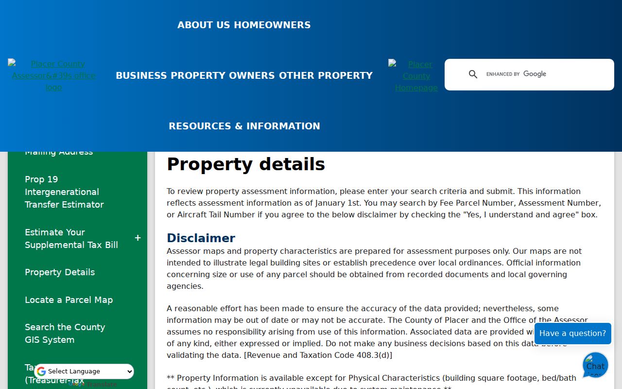
The property-details reference shows why the street directory route moves from a map address to a supported parcel key. The live county interface remains the authority for the current field labels and displayed account data.
Placer County Street-Linked Records
Several record sets can be connected to an address, but each says something different. Use the table as an authority map. It is not a promise that every source exposes a street-wide browse mode or every household.
| Record set | Keeper | Address connection | What it cannot establish |
|---|---|---|---|
| Tax account | Assessor / Treasurer-Tax Collector | Parcel, situs, tax context, lawfully displayed ownership fields | Every occupant |
| GIS parcel layer | Placer County GIS | Boundaries, APNs, nearby parcels, jurisdiction | Occupancy |
| Recorded instruments | Clerk-Recorder | Party, instrument, date, reference | People who never held title |
| Permit files | County or city custodian | Site address, work, dates, named project participants | Applicant's residence |
| Directories and census | Libraries, archive, federal collections | Dated name and address snapshots | Continuous presence |
| Approved voter extract | California Elections | Residence and precinct fields in a lawful file | Public browsing by any visitor |
The APN is the bridge between current parcel tools and the Recorder. A street name is useful for a directory or census search, while a legal description protects against a false chain. Keep the date and source beside every name.
Placer County Assessor Fields and Limits
The Assessor determines ownership and valuation, while the Treasurer-Tax Collector publishes tax information. California Government Code §7924.205 limits posting assessor ownership information on the Internet when the requester searches by an assessee's name, unless another law allows it. That rule explains the address and APN emphasis in the Placer County street directory.
| Field or control | Type | Use |
|---|---|---|
| Fee Parcel Number | 12-digit text | Primary Assessment Inquiry route. |
| Assessment Number | 12-digit text | Alternative tax-account key. |
| Property address | GIS search | Locate the parcel before opening tax details. |
| Tax year | Optional selector | Compare available roll context. |
| Owner name | Restricted Internet mode | Do not treat as a general name-first search field. |
Assessment data reflects the January 1 lien date. A deed recorded after that date may not appear in the roll until a later update. A parcel's value or mailing field also does not tell the complete story of a block. It is one official layer in the chain.
Placer County Deed Chains by Address
Recorder searches are party-indexed, not a dependable raw street search. After GIS and tax research produce an owner name or APN, use the Placer County Recorder CountyFusion index to locate the current acquisition instrument. Search spelling variants and document references. Then read the grantor as the earlier owner and search that person or entity as a prior grantee.
At each step compare recording date, document type, APN, and legal description. A name can hold several parcels. An APN can change after subdivision or a lot-line adjustment. The online index provides reference data, while scanned images are available at the Recorder office or through a copy request. The real-property page lists a $2 first page and $1 additional page noncertified copy price, with other fees explained by the office.
- Parcel
- A mapped tax unit, not a list of every household inside it.
- Situs address
- The physical location tied to the account, distinct from a mailing destination.
- Plat
- A recorded map that can help explain subdivision lots and changed parcel lines.
- Criss-cross directory
- A street-order directory section that may connect an address to a dated occupant or business.
Placer County Permits and Jurisdiction
Permit records date construction, alteration, or inspection activity. They do not turn an applicant, contractor, or owner field into a residence claim. First decide whether the parcel is unincorporated or inside Auburn, Colfax, Lincoln, Rocklin, Roseville, or Loomis. Around growth areas, the postal city name is not enough.
For unincorporated property, Permit Research offers Building, Planning, Engineering, Sewer, Public Works, Tahoe permitting, and Land Capability Verification modes. The county says older searches can use January 1, 1900 as a start date. Its dedicated Building Permit Research Request asks for APN, site address, contact information, permits sought, and locator detail. The newer guidance says up to 20 business days, with electronic copies free and paper at $0.96 per page effective July 1, 2026. Legacy records may require archive or microfilm research.
Use the Placer County Permit Research page for the route and the dedicated research request for an unincorporated parcel. City-held records belong to the relevant municipal building division.
Placer County Reverse Directory Trails
Later criss-cross directories can supply an address view that current parcel records cannot. A county-hosted report documents Haines editions from 1970, 1974, 1980, 1985, and 1989, followed by Cole Information Services editions from 1992, 1995, 1999, 2003, 2008, and 2013. These editions prove that address-keyed volumes were consulted in local work. They do not prove a complete countywide run or a public shelf copy for every year.
Choose an exact volume. Check its table of contents for a street or reverse section. Record the number, street, occupant or business, and adjacent entries. Then flip to the alphabetical section for a spouse, occupation, or alternate address. Publisher abbreviations vary. Photograph the title page, coverage page, abbreviation key, and target entry together when the repository allows it.
Older address problems need maps. The Library of Congress Sanborn collection includes local sheets for Auburn, Roseville, Lincoln, Rocklin, Colfax, Dutch Flat, Newcastle, Loomis, and Penryn in specific years. A Sanborn map shows footprints, street names, numbers, and building use. Pair it with an assessment roll or directory for a person connection. The historical collection itself is covered in the Placer County Directory Book.
Postal Places and Placer County Custody
ZIP and postal city labels can mislead a street search. Granite Bay and Tahoe City are recognizable communities but are not incorporated city governments. Newcastle, Penryn, Meadow Vista, Foresthill, Dutch Flat, and Gold Run are often unincorporated. County Community Development is the likely permit custodian after GIS confirms the parcel, while a city parcel may use a municipal system.
Roseville's 95661, 95678, and 95747 areas, and Rocklin's 95677 and 95765 areas, also show why a name or street without a ZIP or APN can merge unrelated parcels. Use the ZIP directory for postal geography and the GIS map for records custody. The county seat and the Recorder counter do not have to be at the same address.
What a Placer County Street Directory Cannot Show
A street directory can connect a parcel to an owner record, map, deed, permit, or dated directory entry. It cannot reveal every household member. Utility customer information, DMV personal data restricted by the Driver's Privacy Protection Act, confidential voters, and protected addresses are not general street-roll fields. A registered voter is not the same category as an occupant, and a neighboring parcel owner is not automatically a nearby resident.
California voter data is not a public neighbor browser. A qualified file application may include residence, mailing, and precinct fields, but Elections Code §2194 restricts purpose and use. The public status tool is self-only. A record request can seek an identifiable disclosable record, but it cannot force a department to build a new list from exempt data.
Lawful use. Use Placer County street and address records for personal research, genealogy, property history, civic understanding, and safety planning. Do not use them to stalk, harass, intimidate, threaten, or repeatedly contact anyone. Confidentiality programs and protected records must be respected.
The strongest address result is a sourced chain: address to GIS parcel, parcel to supported tax key, tax key to recorded instrument, and dated directory or census evidence for past occupants. If the question shifts to one person, use the Placer County resident lookup route instead of stretching a street record beyond what it says.